


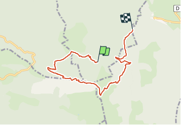
LE MONT BARAL

RD78-38
User

Length
7.8 km

Max alt
1881 m

Uphill gradient
474 m
Km-Effort
14.9 km

Min alt
1201 m

Downhill gradient
710 m
Boucle
No
Creation date :
2021-08-20 08:19:12.0
Updated on :
2021-08-20 14:49:08.217
4h30
Difficulty : Medium

FREE GPS app for hiking
 SityTrail
IGN / Geographical institutes
SityTrail Plus
The world is yours!
About
Trail Walking of 7.8 km to be discovered at Auvergne-Rhône-Alpes, Isère, Le Monestier-du-Percy. This trail is proposed by RD78-38.
Description
Très beau panorama à 360 degrés au sommet,dernière partie un peu raide sino montée tranquille.
Positioning
Country:
France
Region :
Auvergne-Rhône-Alpes
Department/Province :
Isère
Municipality :
Le Monestier-du-Percy
Location:
Unknown
Start:(Dec)
Start:(UTM)
707867 ; 4959539 (31T) N.
Comments